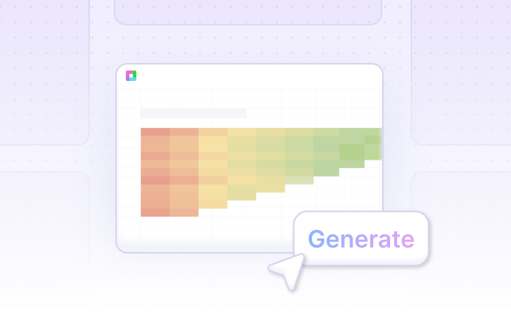
Generate a Contour Chart with AI
Create custom Contour Charts with Sourcetable AI. Generate data from scratch or upload your own to get started.

Introduction
Creating a Contour Chart can be a powerful way to visualize data gradients and variations across a geographic or any structured representation. Users can choose to use AI tools like Sourcetable, which simplifies the process considerably, or traditional spreadsheet programs such as Excel or Google Sheets. Sourcetable enhances spreadsheet functionality with an AI assistant that can create charts, graphs, and more with ease.
For those new to Contour Charts or seeking to streamline their data visualization processes, Sourcetable provides a user-friendly platform. It ensures that even novices can quickly become competent spreadsheet users. By contrast, traditional methods require more manual effort and expertise but are widely accessible and familiar to most users.
To explore how to generate your first Contour Chart effortlessly, sign up for Sourcetable here or continue reading for detailed instructions on both AI-driven and conventional methods.
See how easy it is to generate Contour Chart with Sourcetable
What is a Contour Chart?
A Contour Chart, also known as a Scatter Plot, is a data visualization tool used for displaying contours to show where plotted points are dense. Unlike traditional scatter plots, the individual points are not displayed.
Visualizing Two Dimensional Point Data
Contour Charts intuitively display two-dimensional point data by showing data trends and correlations between two dimensions. This makes them ideal for visualizing and assessing data distributions effectively.
Identifying Outliers and Trends
Contour Charts excel in making outliers easy to identify by visually grouping regions of higher point density. They provide a clear representation of data trends and correlations, aiding in comprehensive data analysis.
When to Use a Contour Chart
Understanding Contour Charts
Contour charts are instrumental for visualizing three-dimensional data in two dimensions. They are ideal for showing levels, gradients, or peaks within a dataset, helping uncover trends and patterns.
Benefits of Contour Charts
Contour charts are particularly effective in scientific and engineering fields where heat maps, elevation models, and potential energy surfaces are analyzed. They allow quick identification of significant areas through color gradation, making complex data more comprehensible.
Drawbacks of Contour Charts
However, contour charts can become cluttered and hard to interpret with excessive contours. They may also require interpolation, leading to potential inaccuracies if the underlying data points are sparse.
Comparison with Other Graphs
Compared to surface plots, contour charts provide a clearer two-dimensional view of data. Unlike three-dimensional graphs, they are easier to print and more accessible for viewers with limited visualization tools. However, scatter plots and heat maps can be more intuitive for datasets that do not require intricate level distinction.
Choosing the Right Chart
Use contour charts when the dataset's granularity allows for meaningful interpolations and clear portrayal of smooth levels. For datasets requiring more precise point representation, consider scatter plots or heat maps as alternatives.
Try Sourcetable For Free
Do anything you want in a spreadsheet using AI. No Excel skills required
Sign Up
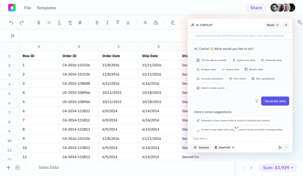
How to Generate a Contour Chart with Sourcetable
- Using Sourcetable's AI spreadsheet, you can easily generate a Contour Chart. Sourcetable offers a straightforward approach, similar to Excel or Google Sheets, but with enhanced AI capabilities.
- First, create sample data using Sourcetable's AI assistant or upload your data via a CSV file. Ensure your data is clean and structured properly.
- Next, select the data range you want to visualize. Highlight the relevant cells that will form the basis of your Contour Chart. Precision in selection ensures a more accurate chart.
- Then, instruct the Sourcetable AI assistant to generate the Contour Chart. The AI process is quick and intuitive, presenting you with immediate visualization results.
- Finally, refine your Contour Chart with the AI assistant. Specify any changes to formatting, labels, and other chart elements to tailor the visualization to your needs.
How to Generate a Contour Chart in Excel and Google Sheets
Creating a Contour Chart in Excel
To generate a contour chart in Excel, first select your data set. Click the "Insert" tab, then select "Recommended Charts." In the "Insert Chart" window, choose "All Charts" and select "Surface." Next, pick the third contour chart option and click "OK" to generate the graph. You can then add a title and customize the chart as desired.
Understanding Contour Plots in Excel
Contour plots represent three-dimensional surfaces on two-dimensional planes and are similar to surface charts. These 2D charts are typically used when you have two predictors and one response. Contour plots are common in fields like cartography, meteorology, and statistics, where they help visualize multi-dimensional data.
Creating a Contour Chart in Google Sheets
In Google Sheets, begin by selecting your data. Click the "Insert" tab and then click the "Insert Waterfall, Funnel, Stock, Surface or Radar Chart" button in the Charts section of the ribbon. Choose the "Surface" chart option to create your contour chart. After creation, you can add elements and format the chart as needed.
Surface Charts in Google Sheets
Surface charts in Google Sheets are useful for comparing multiple data sets. They work best when all data sets share the same axes labels. Once the surface chart is created, it can be customized further by adding elements and formatting as required.
Use Cases of a Contour Chart in Data Visualization
Weather Pattern Analysis |
Visualizing data with a Contour Chart is highly effective for analyzing weather patterns. It helps in identifying areas with similar weather conditions by displaying variations in temperature, humidity, or pressure over a geographical region. |
Topographic Mapping |
Contour Charts are essential tools in topographic mapping. They allow for the depiction of elevations and depressions in landscapes, making it easier to understand terrain features such as hills, valleys, and slopes. |
Heat Distribution in Engineering |
In engineering, Contour Charts provide a clear visual representation of heat distribution across different materials or surfaces. This enables engineers to design more efficient cooling systems and improve material performance. |
Market Research & Analysis |
Contour Charts are valuable in market research to visualize consumer behavior patterns. They can illustrate areas with high or low market activity, aiding in strategic decision-making for product placements and marketing campaigns. |
Medical Imaging |
Contour Charts play a critical role in medical imaging by visualizing data such as MRI and CT scans. They help in identifying and diagnosing medical conditions by showing detailed internal structures of the body. |
Environmental Monitoring |
Environmental scientists use Contour Charts to monitor pollution levels, track changes in ecosystems, and identify areas affected by environmental hazards. This information is crucial for implementing conservation and remediation efforts. |
Frequently Asked Questions
What is a contour?
A contour is a set of elevation lines.
What does sea level represent on a contour map?
Sea level is the zero elevation contour line.
How are depths below sea level shown on contour maps?
Depths below sea level are shown with negative numbers and are typically indicated with shades of blue.
How often are contour lines drawn?
Contour lines are positioned every 2 feet in elevation.
What information does the distance between contour lines convey?
The distance between contour lines indicates the slope steepness; a small distance indicates a steep slope, while a large distance indicates a gentle slope.
Conclusion
In this guide, we explored the essentials of creating a Contour Chart, a valuable tool for visualizing complex data. We discussed how to generate this type of chart using AI through Sourcetable, as well as traditional methods using spreadsheet programs like Excel and Google Sheets.
Sourcetable enhances this process with its AI-driven capabilities, making it simpler and more efficient to create comprehensive charts and graphs. By leveraging Sourcetable's AI spreadsheet and assistant, users can quickly transform raw data into insightful visual representations.
Ready to streamline your data visualization tasks and enhance your analytical capabilities? Sign up for Sourcetable today and create your first Contour Chart effortlessly.
Try Sourcetable For Free
Do anything you want in a spreadsheet using AI. No Excel skills required.
Sign Up
Recommended Guides
Connect your most-used data sources and tools to Sourcetable for seamless analysis.

Frequently Asked Questions
If your question is not covered here, you can contact our team.
Contact UsHow do I analyze data?
What data sources are supported?
What data science tools are available?
Can I analyze spreadsheets with multiple tabs?
Can I generate data visualizations?
What is the maximum file size?
Is this free?
Is there a discount for students, professors, or teachers?
Is Sourcetable programmable?
Generate beautiful Contour Charts with AI
Turn your ideas into custom visualizations. Generate or upload your data and Sourcetable AI does the rest. Try Sourcetable for free to get started.